
Since January, our highway in Costa Rica, Ruta 27, counts with drones as an additional tool for monitoring our Concession. Thus, the Quality and Technical Office Departments have high-end drones specialized for civil works and topography at their disposal.
Using the new equipment helps our colleagues optimize the monitoring tasks of the route and keep a detailed record of the progress of the works, the inspection of slopes, and, in general, any need that may arise on a day-to-day basis.
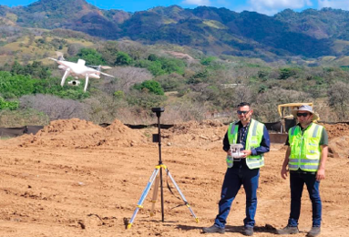
Two colleagues of Ruta 27 testing the new equipment.
In the case of the Quality Department, the flight of each of the drones is carried out in pairs, so one person is in charge of piloting the drone. At the same time, the other is in order of providing security support so that the tasks monitoring are carried out with the maximum security guarantees.
The equipment that is used counts with an RTK (Real Time Kinematic), or what is the same, a satellite kinetic navigation in real-time. It is a technique used for topography, agricultural machinery, and marine navigation using phase measurements of navigators with GPS signals. In this type of navigation system, a single reference station provides corrections in real time, obtaining submeter accuracy.
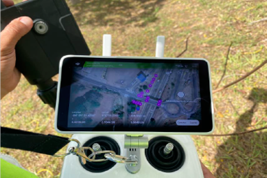
Aerial view captured by the equipment for monitoring the route.
On the other hand, in the case of the Technical Office Department, the equipment used is more straightforward and can be piloted by a single person. With this drone, our Ruta 27 engineers monitor the work carried out throughout the project.
With the incorporation of drones in monitoring tasks, our Costa Rican Concession Ruta 27 is committed to the latest technological advances as a complementary tool to optimize our teams’ work and thus improve our Concession’s day-to-day life.
.